
Trek date: 12th August 2018 - 15th August 2018
Disclaimer: I’m writing this in 2022, doing my best to recollect events in the past, piecing together things that happened from notes, photos and my fallible memory.
I’d arrived in Leh, Ladakh, and as usual had no plan but to enjoy the mountain air. Staying at HostelLaVie on the outskirts of town of Leh and fell in with a bunch of good people spending our first day scooting around Leh seeing all the stunning monasteries.
After a long day and while chilling out in the common room we got talking to someone who had hiked the Markha Valley and got the valuable insights of someone who had just completed the thing you want to do.
Getting to the start of the Markha Valley Trek
The Markha Valley is nearly entirely cut off from roads and only accessible by foot. So you’ll need to get to the closest town which is Chilling. There are two options to get there, a bus or a private taxi. Being part of a group we opted to split a taxi, the bus option was tempting but the timetable at the time would mean starting at midday. With weather on the warm side it's easier to start early in the cooler temperatures. A bonus with the taxi is that it can (for an extra fee) take you beyond the town to the where the trail begins, saving you a few kilometers of walking.
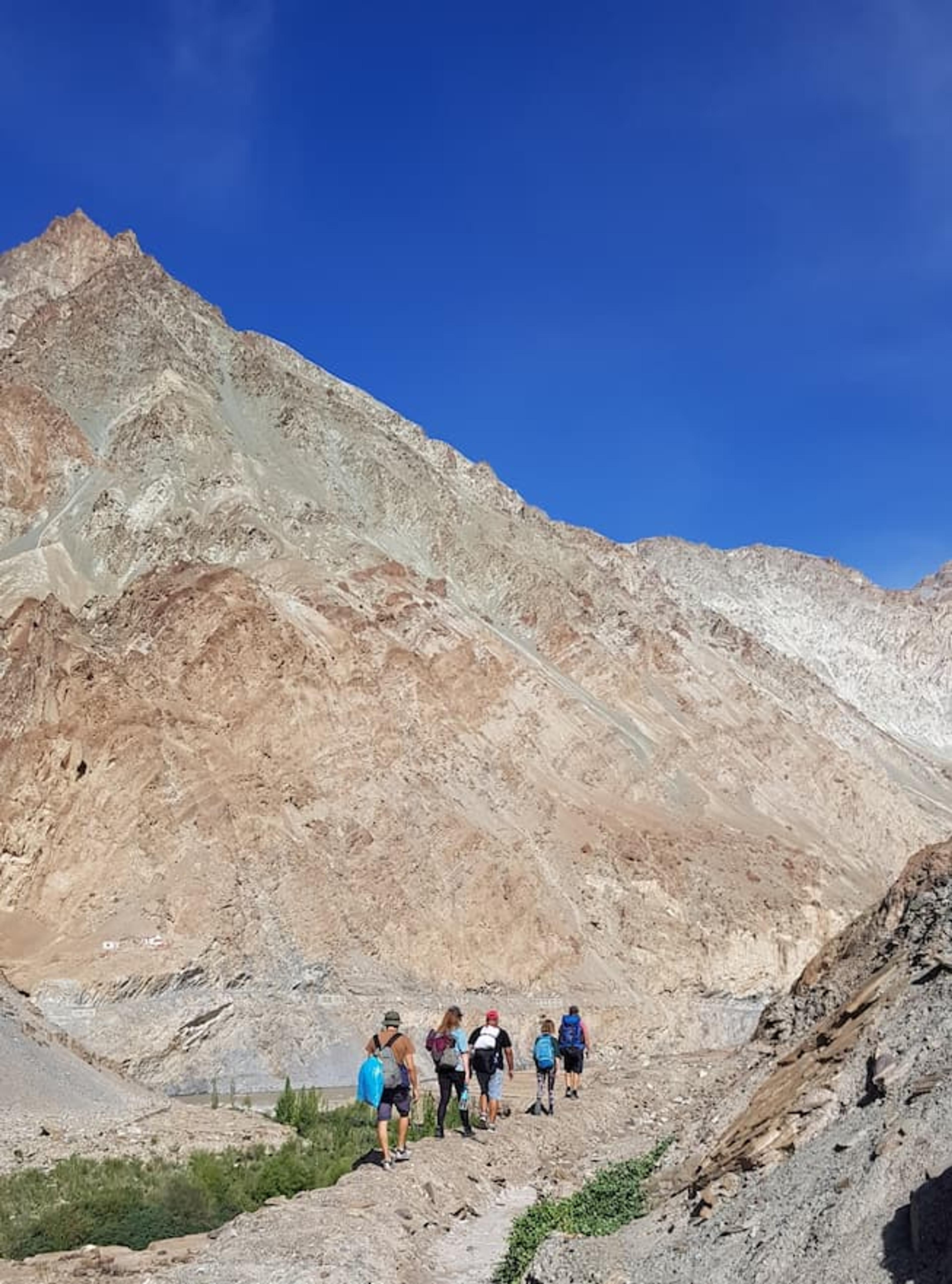
Day 1 - Chilling to Sara | 19 km | +400 m
Starting at the bridge, we walked across and followed the advice of follow the poo. Presumably this was from the mules or horses from guided groups and locals getting supplies in. We did somehow go immediately wrong and started down a pass which became extremely narrow and treacherous, quite high up on a ridge with the potential to fall. We wisely decided to double back and check for another path, which we promptly found.
The bad luck comes in twos, I’m a bit of a quick walker and pulled ahead of the group and approached a valley and noticed a house submerged into the ground. Thinking that I could take a nice photo, I approached it and paused to consider. This was a mistake, as I started sinking into the ground. I had stumbled into a not quite settled mudslide, and got stuck. I was lucky that i walked as far as i did as i was near the edge of the mudslide area. My second bit of luck was that a guided tour group was just behind me and the guide helped me out with a large branch. As I crawled along it I could feel my shoes starting to be sucked off by the mud and balled my toes up in the hopes they would stay on. Thankfully they did and didn't cut short the whole hike.
The rest of the day went without incident and for the most part the first day's walk was quite flat with only a gentle accent at the beginning. We found a home about 10km in that had a sign outside selling basic meals which we stopped off at for lunch. In total it was about 19km to get to the homestay in Sara, the homestay offered dinner, breakfast the next day and a packed lunch.
Day 2 - Sara to Hankar | 20 km | +490 m
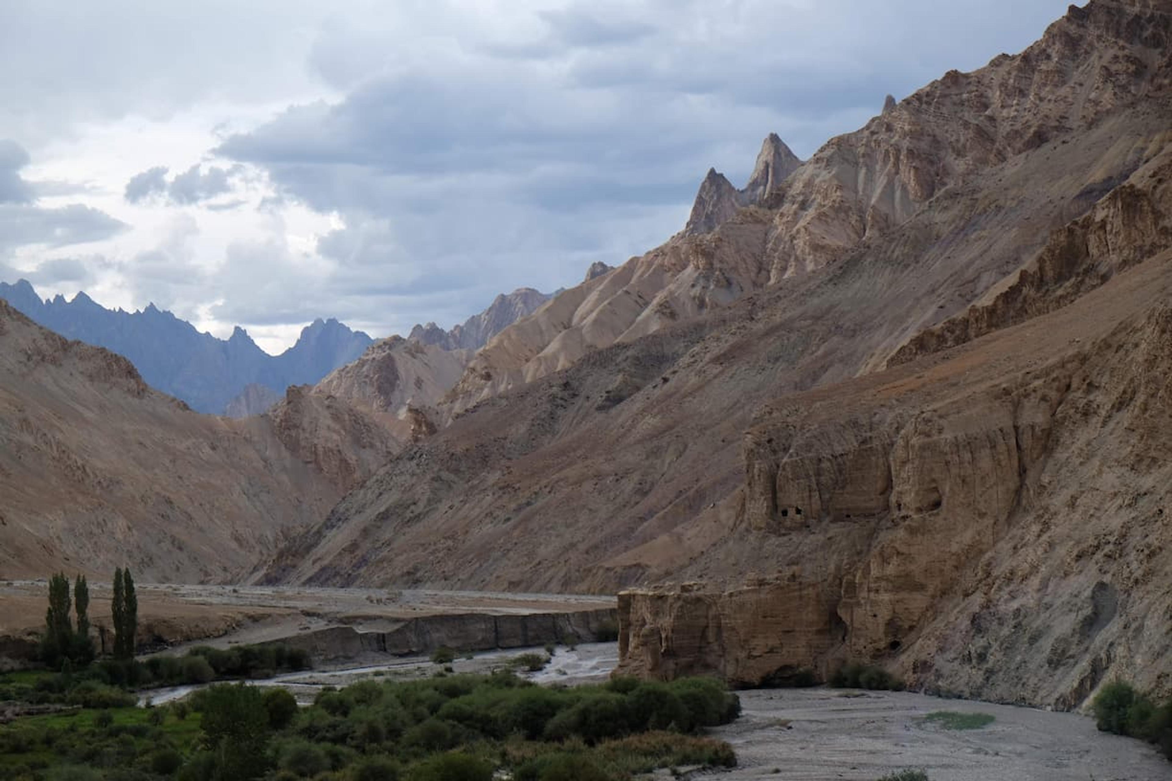
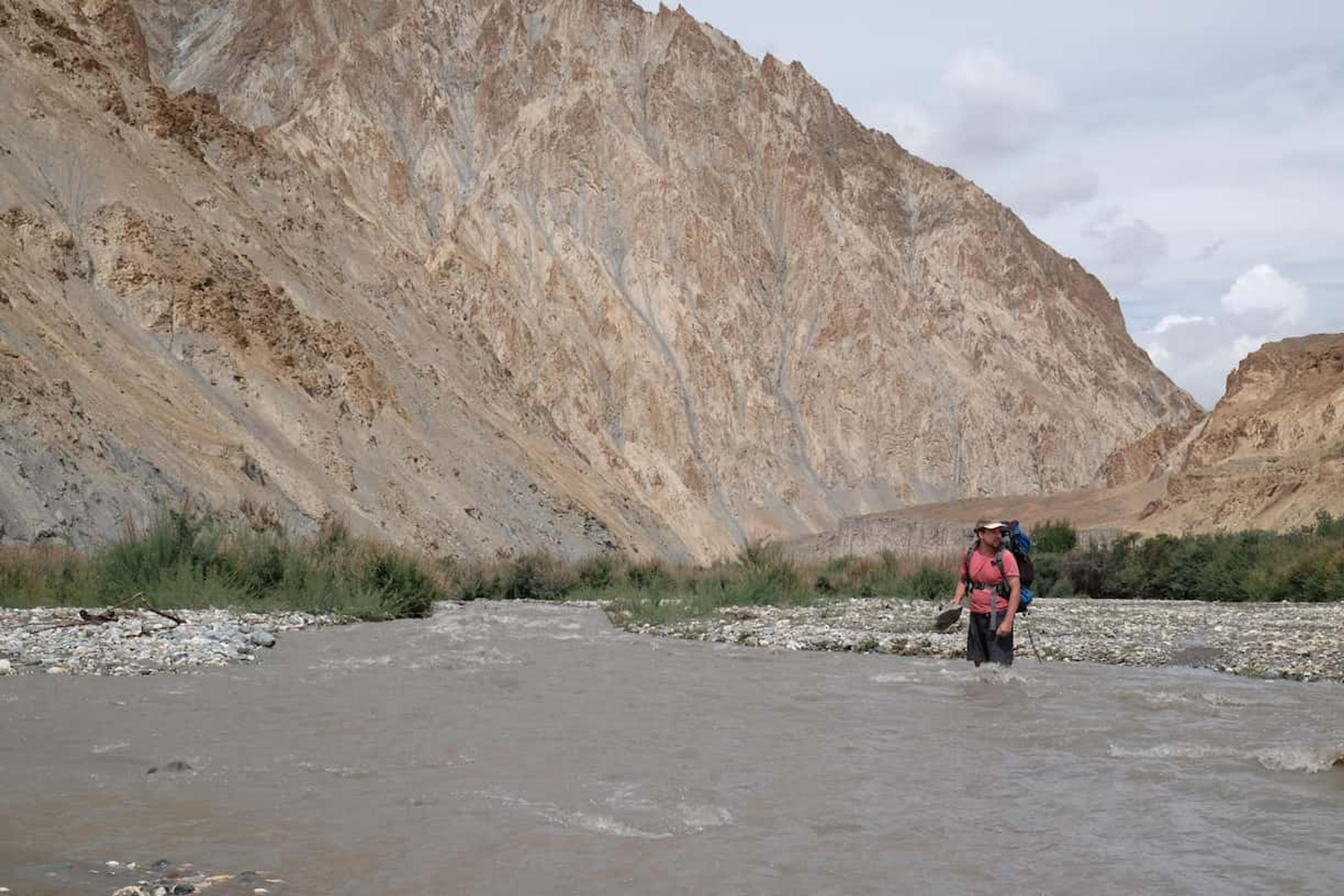
Another gradual accent, so not a difficult day of hiking. The main challenge was the path crossing the river fairly regularly, and there wasn't always a bridge to cross. So depending on the snow melt you’ll probably have to take off your shoes and wade across, it only came up to our knees when crossing in August, but take caution.
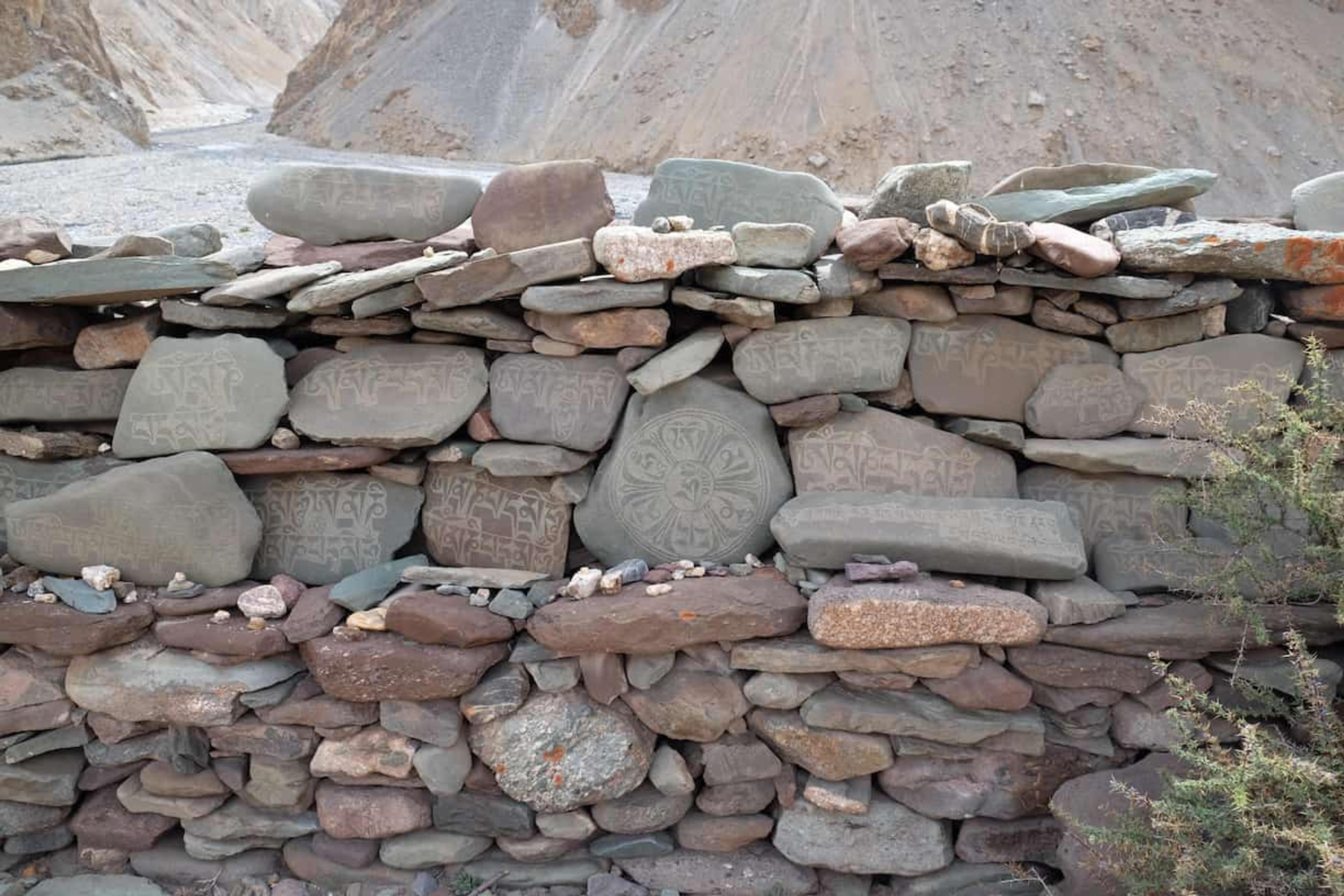
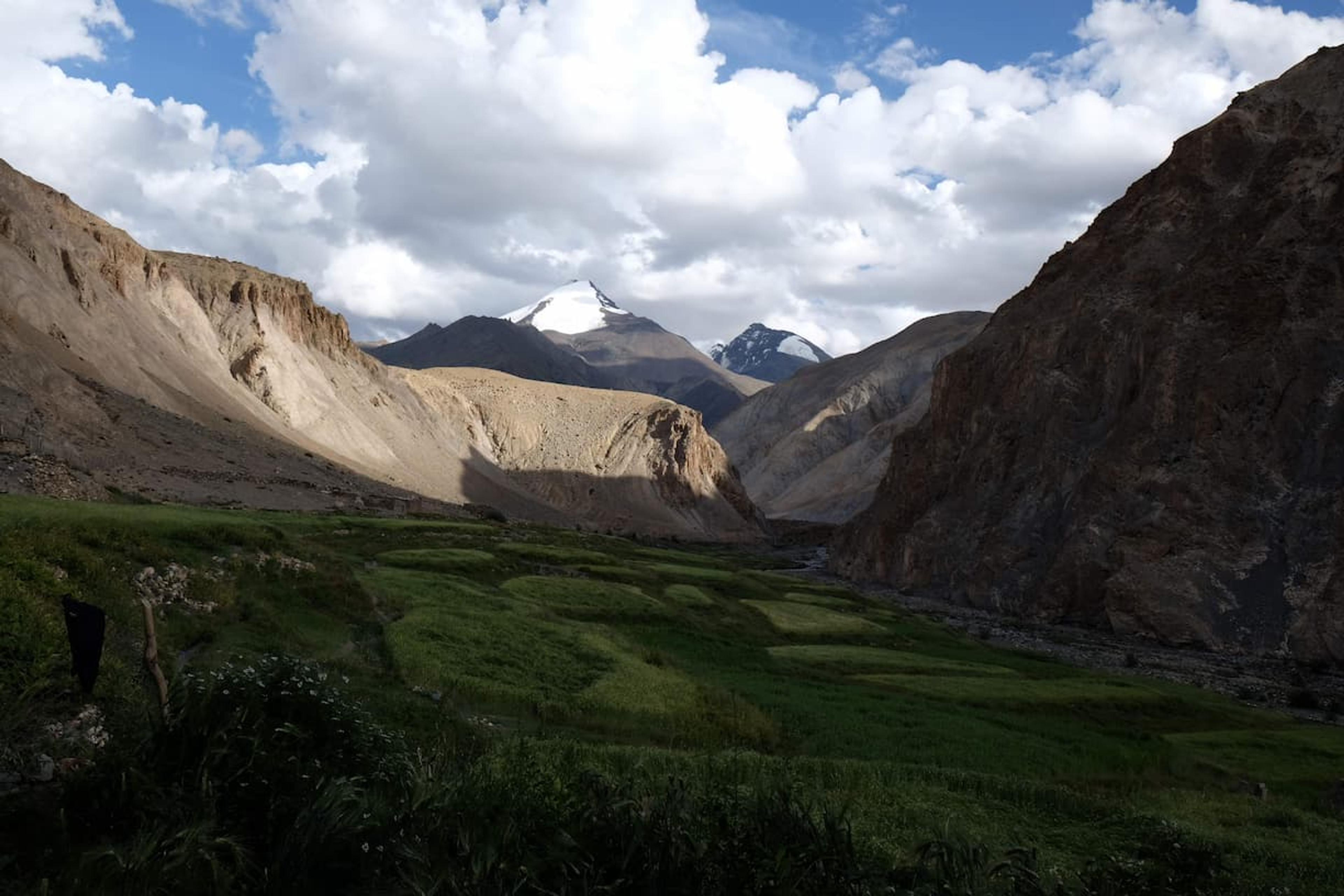
The scenery is truly beautiful, I would say that. Being in the mountains is one of my favorite things to do, but Markha Valley provided some desert-esk landscapes I'd not seen before, and occasionally contrasted with oases of green. Also there's a ton of art along the way, iconography of what I think are Budist in nature.
Hankar was a great stop, our homestay had a great view across to the nearby mountain peaks.
Day 3 - Hankar to Nymaling | 11 km | +820m
A shorter distance to cover, but much higher to climb. Here the temperature begins to transition from the quite warm sweaty hiking to much cooler temperatures.
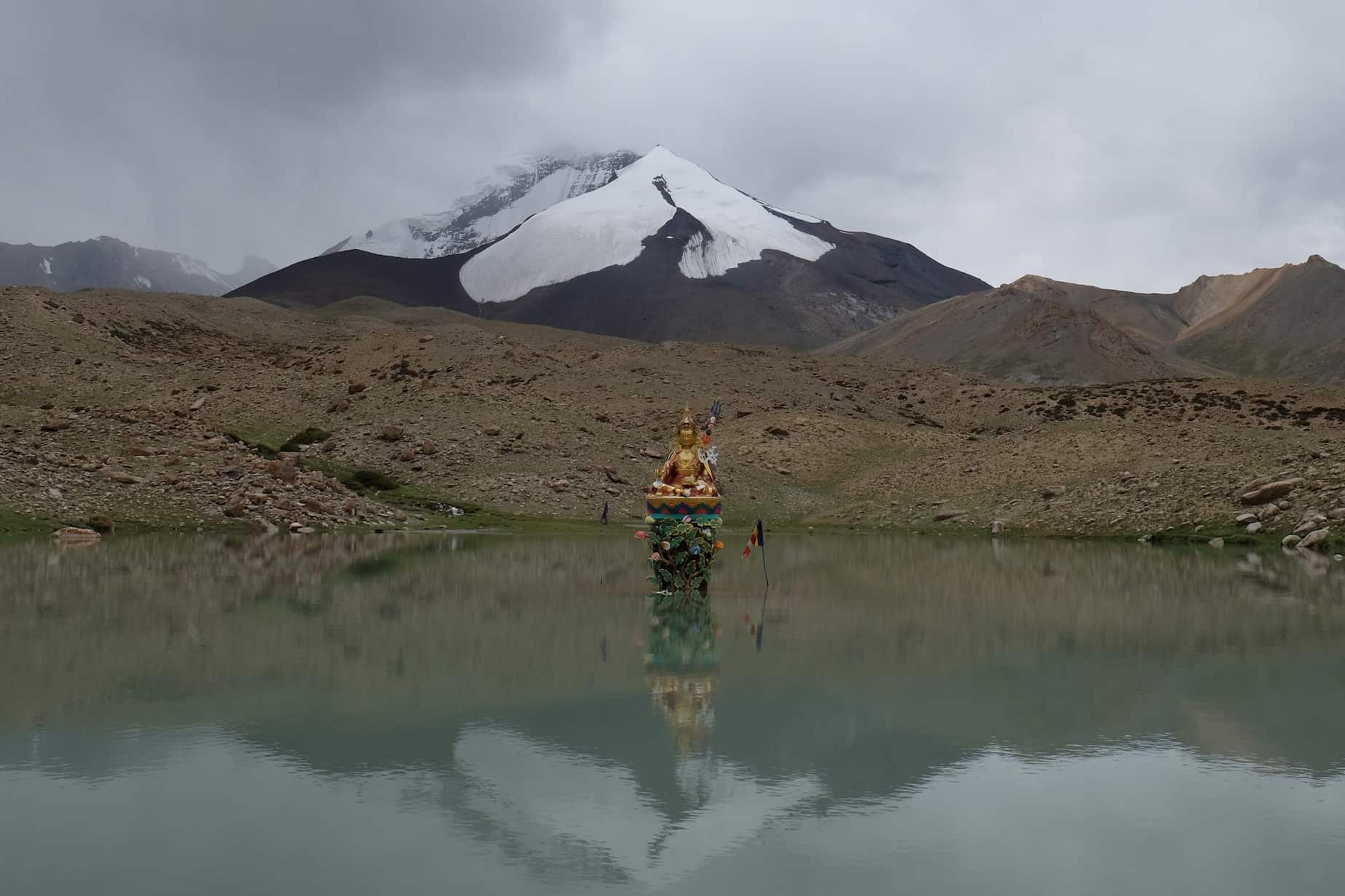
At roughly the halfway point there is a picturesque stop off point by a lake with a statue in the middle, the backdrop is stunning.
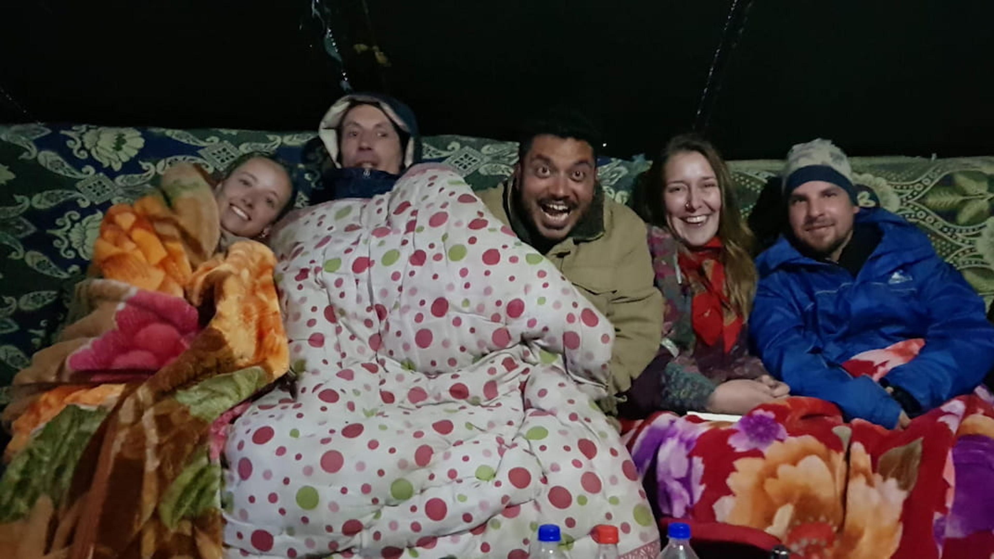
The campsite a Nymaling was the most expensive of the stays, but prices are likely to vary after time so check before you go how much money you need to take with you. They provided good meals, and there was a central tent acting as a common room, I don't recall any heating but there were plenty of blankets. Make sure you bring some warm layers with you, at that altitude it gets cold when the sun goes down.
Day 4 - Nymaling to Kangmaru La (+430m) to Chokdo | 11 km | -1.3 km
Breakfast is served early and the people staying at the campsite will inevitably set off to scale the last bit to get to the top of Kangmaru La pass all roughly at the same time. It's a switch back and not particularly difficult; you just need to dig deep and keep climbing.
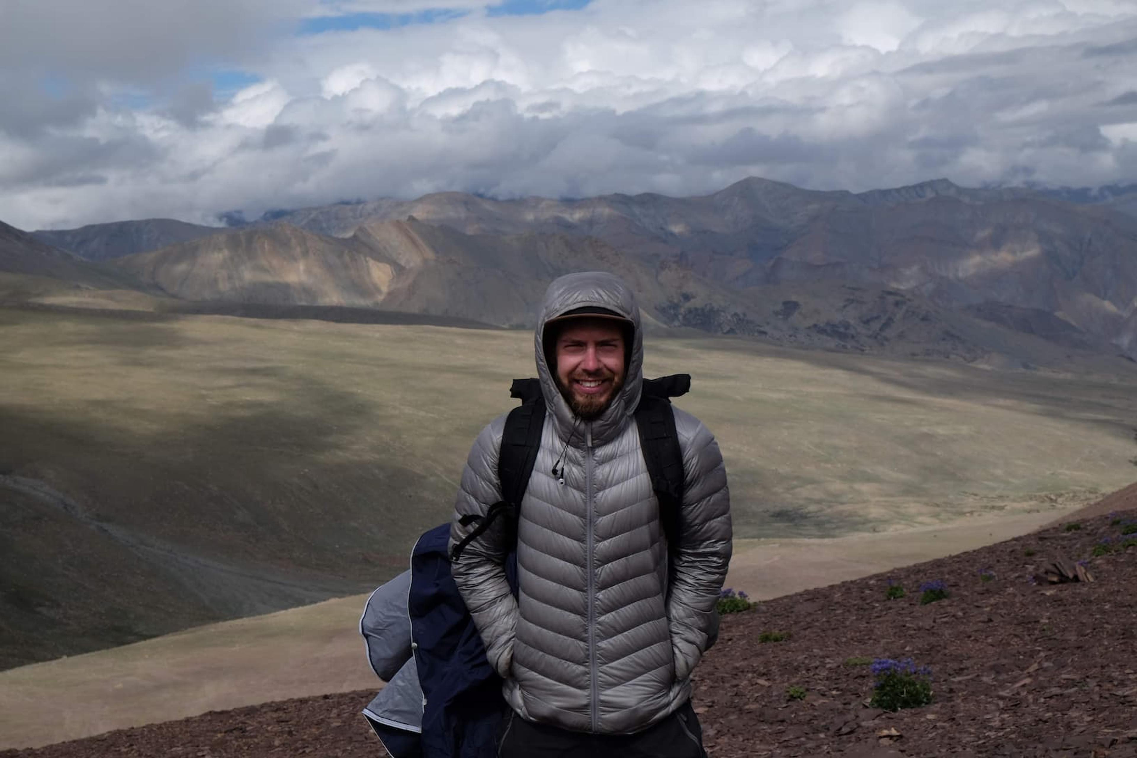
After scaling to the top you get treated with a great view but it's going to be windy up there and it's cutting. I tried to endure it as long as possible and then was quite keen to start the way down, where it starts to warm up fast. The descent to Chokdo was a fun one, you mostly followed along a flowing river with some more challenging narrow paths.
Getting Back
On arriving to Chokdo you'll find some taxis waiting for hikers to take back to Leh or nearby towns. But you can also pre organise your taxi as well.
Thinking about it back, I think we preorganized our pickup, it did seem like we got picked up in the middle of nowhere, the taxi was waiting where the road just ended. I don't particularly remember a village or any houses nearby, we must have driven a few kilometres before we actually hit the town of Chokdo.
Advice
- Bring some warm layers with you.
- The homestays do provide dinner, breakfast and a packed lunch, but you'll probably need some snacks.
- I think there was one very remote "shop" on the second day
- I filled my water bottle before going, and then relied on my straw purifier after that using water from the river.